
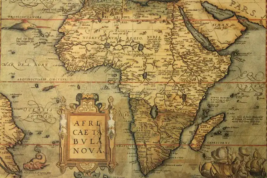
Addis Ababa: The African Union (AU) has formally endorsed a campaign to eliminate the widespread use of the 16th-century Mercator map by governments and international organizations, advocating instead for maps that more accurately represent Africa’s size.
The Mercator projection, created by cartographer Gerardus Mercator for navigation, enlarges regions near the poles, such as North America and Greenland, while shrinking regions in the southern hemisphere, including Africa and South America.
Selma Malika Haddadi, AU Commission deputy chair, said that the map fosters a false impression of Africa as marginal, despite it being the world’s second-largest continent, home to over 1 billion people. She added that the distorted representation has influenced media, education, and policy.
The call to replace Mercator has existed for decades, but the Correct the Map campaign, led by advocacy groups Africa No Filter and Speak Up Africa, has revitalized the debate. The campaign urges institutions to adopt the 2018 Equal Earth projection, which reflects countries’ true sizes.
The African Union has joined the call to replace the outdated 16th-century Mercator map which distorts Africa’s true size, with the Equal Earth projection, a map that shows the continent as it really is: vast, powerful, and central to our world. #CorrectTheMap
💬 “It might seem… pic.twitter.com/w32jt3ExsI
— African Union (@_AfricanUnion) August 14, 2025
“The current size of the map of Africa is wrong. It’s the world’s longest misinformation and disinformation campaign, and it just simply has to stop,” said Moky Makura, executive director of Africa No Filter.
Fara Ndiaye, co-founder of Speak Up Africa, said the Mercator map affects Africans’ identity and pride, particularly children exposed to it early in school. “We’re actively working on promoting a curriculum where the Equal Earth projection will be the main standard across all African classrooms,” Ndiaye said.
The union plans to advocate for wider map adoption and coordinate actions with its 55 member states. The Mercator projection remains widely used in schools and by tech companies. Google Maps switched from Mercator on desktop to a 3D globe view in 2018, though mobile apps still default to Mercator.
Correct the Map has petitioned major organizations, including the World Bank and the United Nations, to adopt Equal Earth. A World Bank spokesperson said the institution already uses the Winkel Tripel or Equal Earth projections for static maps and is phasing out Mercator online. A UN spokesperson confirmed that any request would need review and approval by a committee of experts.