
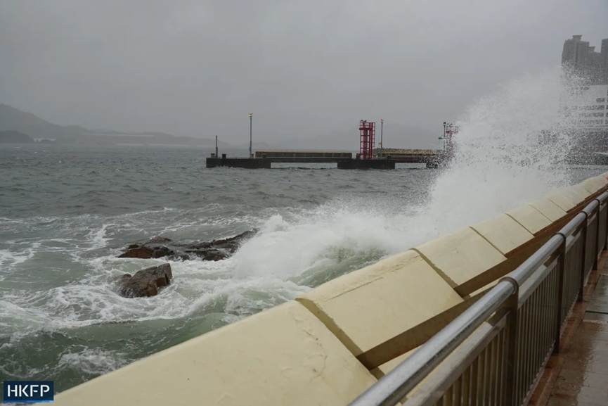
Hong Kong: Hong Kong has issued its highest storm warning signal as Typhoon Wipha lashed the territory with torrential rain and hurricane-force winds, disrupting transport, cancelling flights, and forcing the closure of schools and daycare centers.
The Hong Kong Observatory raised the No. 10 tropical cyclone warning, the city’s most severe storm alert at 9:20 a.m. local time (0120 GMT), indicating sustained winds of over 118 km/h (73 mph).
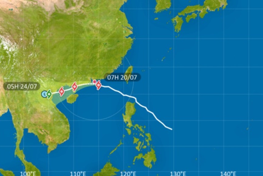
The storm was located about 60 kilometers southeast of the city as of 10 a.m., with its eyewall bringing violent winds particularly to southern Hong Kong.
More than 500 flights were cancelled at Hong Kong International Airport, including all Cathay Pacific arrivals and departures between 5 a.m. and 6 p.m. The airline waived change fees and offered rebooking options for affected passengers. Around 400 more flights were scheduled to take off or land later in the day, depending on weather conditions.
Most forms of public transportation were halted, including ferries, due to dangerous sea swells. Train services operated on limited schedules, with operations on open-air lines suspended. Authorities also cancelled all Sunday classes at day schools and daycare centers as a precaution.
In mainland China, the provinces of Hainan and Guangdong were placed on high alert, as Wipha’s outer bands threatened to impact coastal communities. The typhoon had already battered the Philippines with heavy rainfall and flooding, leaving two people missing, according to the country’s National Disaster Risk Reduction and Management Council.
Typhoon Wipha is the strongest storm to prompt a T10 warning in Hong Kong since Super Typhoon Saola struck in 2023. The Hong Kong Observatory urged residents to remain indoors and to take all necessary precautions, warning of destructive winds and considerable threats to life and property as the typhoon skirted just 50 kilometers south of the city.